
18 Scenic Utah Drives to Take Before the Roads Close This Fall
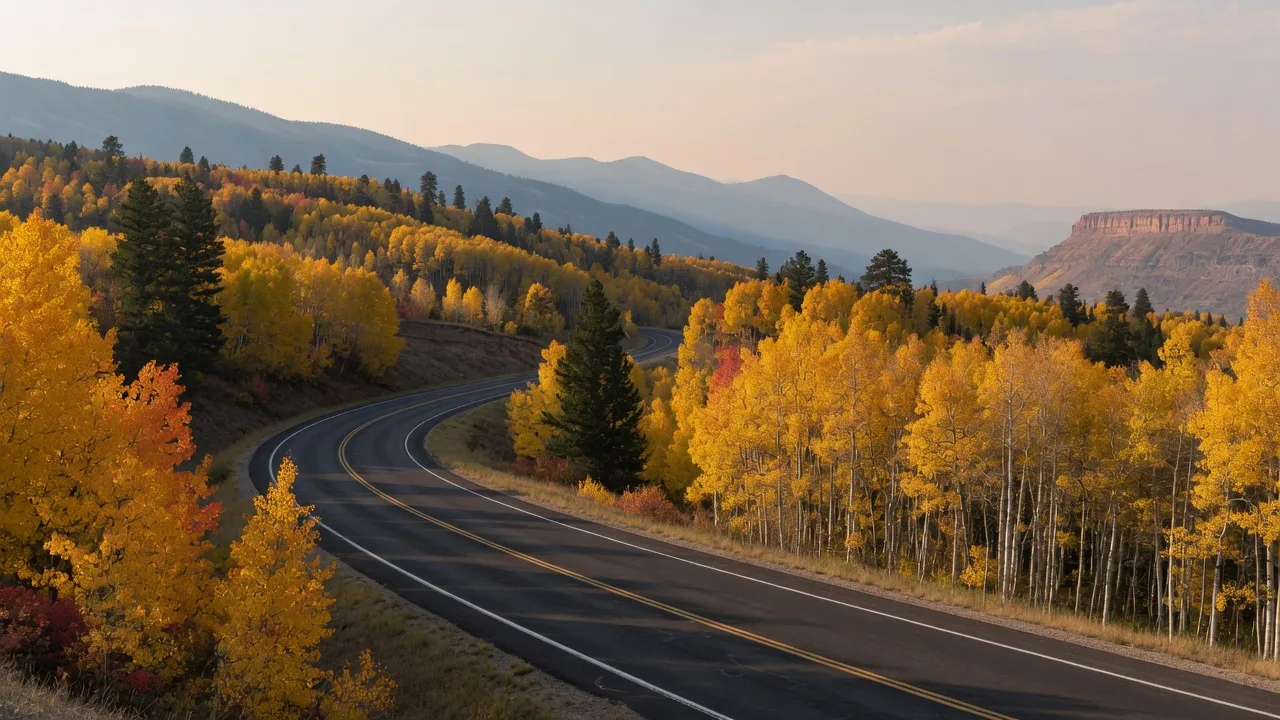
Several of Utah's best mountain drives are about to close for the winter, so consider this your friendly reminder to get out there while you still can. Right now, in fall 2026, is the window: the aspens are still turning, the air is crisp, and the seasonal roads are open. A few of the routes below are quick afternoon detours, a few are full-day trips, and all 18 of them are worth the gas.
Before you head out, check current UDOT road conditions, and plan for a few specifics along the way: one route needs a recreation pass, a couple need high clearance or dry gravel, and most of the mountain summits are far colder than the valley. Then pick a road and go.
The 18 scenic routes every Utahn should drive at least once
Here is the whole list, in order, with the distance, the season, and the one thing to look for on each route.
-
1. Logan Canyon Scenic Byway
41 miles · Best in fall
When you reach the Bear Lake overlook, give the water a real look. That bright turquoise comes from tiny limestone particles suspended in the lake, and it is the whole reason people pull over and stare.
-
2. Flaming Gorge–Uintas Scenic Byway
82 miles · Summer to fall
North of Vernal, watch for the roadside signs that name each rock layer you are driving past. Between them you cover hundreds of millions of years of geology on the climb toward Manila and Sheep Creek.
-
3. Mirror Lake Scenic Byway
55 miles · Summer to early fall
Pull over at Provo River Falls, which cascades right next to the road on the way from Kamas over Bald Mountain Pass. If you stop anywhere along the highway, you need a recreation pass, so grab one before you go.
-
4. Big Cottonwood & Guardsman Pass
30 miles · Summer to fall
Park at Brighton and walk the flat boardwalk loop around Silver Lake, then take Guardsman Pass for the view down toward Park City and the Heber Valley. A lot of scenery for a short afternoon.
-
5. Alpine Loop Scenic Byway
20 miles · Summer to fall
Mount Timpanogos fills your windshield for most of the run from American Fork Canyon to Provo Canyon via Sundance. The road is narrow and twisty enough that vehicles over 30 feet are not allowed, so this one is a car trip, not an RV trip.
-
6. Nebo Loop Scenic Byway
38 miles · Summer to fall
Stop at Devil's Kitchen for a short walk to red hoodoos that look like a mini Bryce Canyon. Mount Nebo, the tallest peak in the Wasatch Range at 11,928 feet, towers over the whole drive from Payson to Nephi.
-
7. Upper Colorado River Byway
44 miles · Spring and fall
Fisher Towers get all the attention along SR-128, but keep going to Dewey Bridge. The 1916 suspension bridge burned in 2008, and you can still see what is left of it on the way from Moab up to I-70.
-
8. La Sal Mountain Loop
60 miles · Late spring to fall
You go from red rock to aspen and pine in less than an hour on the loop from Moab through Castle Valley. Look back over Castle Valley on the way down for the best view of Castle Rock.
-
9. SR-24 through Capitol Reef
48 miles · Year-round
Stop at the petroglyph boardwalk right off the highway to see carvings left by the Fremont people on the stretch between Torrey and Hanksville. If it is in season, grab a pie at the Gifford Homestead in Fruita on the way.
-
10. Burr Trail
66 miles · Spring and fall
The gravel switchbacks drop you down the Waterpocket Fold, a wrinkle in the Earth's crust nearly 100 miles long, on the way from Boulder to Bullfrog. Near Boulder, watch for Singing Canyon, a short slot right off the road in Long Canyon.
-
11. Shafer Trail
18 miles · High-clearance 4WD
One of those drives you remember: it started as a cattle trail and was widened in the 1950s for uranium trucks, and today the switchbacks drop from Island in the Sky toward Potash Road. It takes high-clearance 4WD, and you should check conditions with Canyonlands before you go, since washouts can close it.
-
12. Moki Dugway
3 miles · Skip it when wet
Built in 1958 to haul uranium ore, the graveled SR-261 switchbacks drop about 1,100 feet in three miles down Cedar Mesa. On a dry day, stop and look out over Valley of the Gods spread out below; when it is wet, pick a different day.
-
13. US-163 to Monument Valley
25 miles · Year-round
Pull over near mile marker 13 for the spot where Forrest Gump stopped running. Along the way, Mexican Hat gets its name from a rock formation that looks like an upside-down sombrero.
-
14. Scenic Byway 12
122 miles · Spring to fall
The long one, 122 miles from Panguitch to Torrey through Red Canyon, and the route that keeps showing up on best-drives lists. Give it a full day and let the overlooks happen.
-
15. SR-14 through Cedar Canyon
41 miles · Year-round
The climb from Cedar City to Long Valley Junction past Navajo Lake is a year-round escape, and in the fall the high aspen stands do the talking through Cedar Canyon.
-
16. Utah's Patchwork Parkway
51 miles · Summer to fall
SR-143 from Parowan to Panguitch via Brian Head crosses some of the highest pavement in the state, with the high country around Brian Head putting on its best show before the snow arrives.
-
17. Kolob Canyons Road
5 miles · Spring and fall
A short spur off I-15 exit 40 that ends at the Kolob Canyons Viewpoint. It is the shortest route on this list and one of the fastest ways to feel like you are deep in red rock country.
-
18. Zion–Mount Carmel Highway
25 miles · Year-round
From Springdale through the tunnel to Mount Carmel Junction, this is the classic Zion experience on pavement, and it runs year-round whenever you can get away.
A few tips before you point the car
The best day for any of these roads starts with a quick conditions check. A few things to keep in mind:
- Check UDOT road conditions before you go. Several of these mountain routes close for winter, and once the snow flies a closure can come with very little notice.
- Skip the gravel when it is wet. The Burr Trail, Shafer Trail, and Moki Dugway change character entirely in mud, and the Moki Dugway is a skip-it-when-wet road by design.
- Plan for the fall colors while they last. The high country peaks before the canyons, so the next stretch of weekends is prime for the mountain routes on this list. For the full timing and more leaf-peeping drives, see our Utah Fall Foliage 2026 guide.
- Give the long routes a full day. Scenic Byway 12, the La Sal Mountain Loop, and the Burr Trail all reward a slow pace and plenty of stops.
What's your favorite drive on the list?
Which route are you most excited to take this fall? Adam and Natalie would genuinely love to hear it, whether it is a canyon you grew up driving or a southern Utah road you finally want to cross off. And if you are considering a home near any of these routes, or you are just curious what life is like living next to one of them, they would love to talk.
Call or text 801-613-0038, or email info@utahcityliving.com. Whether you are scouting neighborhoods along the Wasatch Front or dreaming about a second home closer to the red rock, they will help you find the corner of Utah that feels like home.