
Best Hikes on the Wasatch Front: A Trail Guide for Salt Lake & Utah County
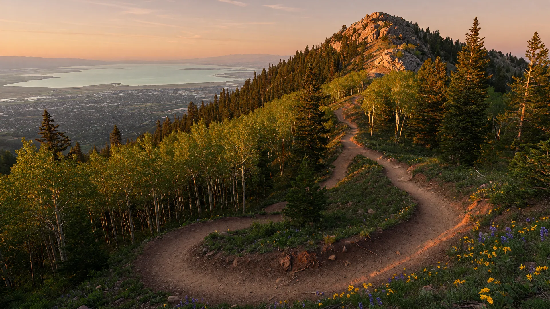
The best hikes on the Wasatch Front are the ones within a short drive of Salt Lake and Utah County homes, and there are many of them. This guide covers twelve of the most popular trails and basins, from a 1-mile city overlook to a 7-mile alpine lake climb, with round-trip distance, elevation gain, difficulty, trailhead fees, and practical notes for each. It is written for residents and visitors alike: hikers who want a summit view, families who want a short waterfall walk, and anyone who wants a flat, paved stroll.
The 12 trails and basins at a glance
Distances and elevation gains below are published figures from the U.S. Forest Service, Visit Utah, AllTrails, and local trail guides. Where sources differ, the most commonly cited figure is shown.
| Trail | Location | Length (RT) | Difficulty | Elevation gain | Best for |
|---|---|---|---|---|---|
| Ensign Peak | Salt Lake City | 1.0 mile | Easy to moderate | ~380 feet | Quick city views, visitors |
| Desolation Overlook | Millcreek Canyon | 4.4 to 5.0 miles | Moderate | ~1,300 to 1,450 feet | Valley overlook, fewer crowds |
| Grandeur Peak | Millcreek Canyon | ~6.6 miles | Hard | ~2,300 to 2,700 feet | Summit payoff, big views |
| Dog Lake | Millcreek Canyon | ~5.2 miles | Moderate | ~1,680 feet | Subalpine lake, leashed dogs |
| Lake Blanche | Big Cottonwood Canyon | ~6.7 to 7.0 miles | Strenuous | ~2,700 feet | Alpine lake, photography |
| Bell Canyon Falls | Sandy | ~4.8 miles | Moderate to hard | ~1,500 to 1,600 feet | Waterfall payoff, close to home |
| Donut Falls | Big Cottonwood Canyon | ~1.5 miles | Easy | ~200 to 370 feet | Families, young children |
| Albion Basin (Cecret Lake) | Little Cottonwood Canyon, Alta | 1.8 to 4.5 miles | Easy to moderate | ~460 to 1,200 feet | High alpine wildflowers, families |
| Stewart Falls | Provo Canyon (Sundance) | ~3.5 miles | Easy to moderate | ~650 feet | Big waterfall, group outing |
| Battle Creek Falls | Pleasant Grove | ~1.5 miles | Easy | ~450 to 500 feet | Quick family waterfall hike |
| Grove Creek Falls | Pleasant Grove | 1.8 to 4.25 miles | Moderate to hard | ~630 to 1,520 feet | Two waterfalls, conditioning |
| Oquirrh Lake Loop | Daybreak, South Jordan | ~3.2 miles (full loop) | Easy | Negligible | Paved flat stroll, strollers, wheelchairs |
Trailhead fees and passes: what you need before you go
Most of these trails are free, but Millcreek Canyon and several Big Cottonwood Canyon trailheads are recreation fee areas. The details matter, so check the list before you drive up:
- Millcreek Canyon (Desolation Overlook, Grandeur Peak, Dog Lake): $5 per vehicle per day, paid when you exit the canyon, card only, no cash. Seniors 60 and over pay $3 per day, and the annual pass is $50 ($30 for seniors). America the Beautiful, National Park, and Utah State Parks passes are not accepted here. The upper canyon road is closed to vehicles from November 1 through July 1.
- Big Cottonwood Canyon (Lake Blanche, Desolation Lake access): there is no fee to drive the canyon, but the Forest Service runs Recreation Enhancement Act (REA) pay-to-park areas at designated trailheads, including the Mill D / Mill D South area (Lake Blanche and Desolation Lake access) and Cardiff Fork. REA passes run about $10 for 3 days, $20 for 7 days, or $60 for an annual pass, paid by credit card through posted QR codes or Recreation.gov.
- Donut Falls trailhead: also a paid REA parking area, about $10 for a 3-day pass paid by card through the posted QR code or Recreation.gov. The lot is small, so expect overflow parking at the Mill D / North Fork lot farther down the road.
- Albion Basin Summer Road, Little Cottonwood Canyon: driving the Summer Road from Alta up into Albion Basin costs a per-vehicle amenity fee of about $12 as of 2025, collected at the toll booth. The fee applies only to driving the road: hikers and mountain bikers can park for free in the Alta village lots and hike or ride up with no charge. The road typically opens early July through mid-October and is busiest during peak wildflower season in mid-to-late July.
- Stewart Falls: free from the Aspen Grove trailhead on the Alpine Loop side. If you come in from the Sundance Resort side, the resort may charge for parking, so check ahead.
- Bell Canyon, Battle Creek, Grove Creek, Ensign Peak, Oquirrh Lake: free parking, no day-use pass required. Bell Canyon enters the Lone Peak Wilderness on its upper sections; no wilderness permit is needed for day hiking.
- A seasonal caveat: UDOT runs a paid parking reservation program in Big and Little Cottonwood Canyons from November 15 through May 15, and REA fee areas can change, so check posted signage or recreation.gov before you go.
Salt Lake County hikes
Ensign Peak: Salt Lake City's quick viewpoint
Ensign Peak is a short, steep out-and-back in the foothills directly above the Utah State Capitol, roughly a mile round trip with about 380 feet of gain. Most hikers finish in 30 to 60 minutes, and the reward is a sweeping view of the Salt Lake Valley, the Great Salt Lake, and the Oquirrh Mountains. It is one of the most historically significant viewpoints in the valley and makes a perfect first hike of the season or a stop for out-of-town visitors. Plan a visit at sunset for the best light.
Parking and notes: the Ensign Peak trailhead is off Ensign Vista Drive and parking is street-only, so arrive early on weekends. No fee or permit is required. The trail is fully exposed, so bring water even on a short trip.
Desolation Overlook via the Desolation Trail: Millcreek's valley view
The Desolation Trail starts from its own parking area on the south side of Millcreek Canyon Road, just past the Millcreek Inn, and climbs about 1,300 to 1,450 feet over a 4.4 to 5 mile round trip. The standard day-hike version ends at the Desolation / Salt Lake Overlook, which opens onto a wide view of the valley. It is rated moderate, gets fewer crowds than Grandeur Peak, and shares the canyon's dog-friendly (on-leash) rules.
Parking and notes: the Desolation trailhead has a dedicated lot, and the Millcreek Canyon day-use fee applies: $5 per vehicle per day paid on exit by card, with $3 per day for seniors 60 and over and a $50 annual pass. America the Beautiful, National Park, and Utah State Parks passes are not accepted in the canyon. The full Desolation Trail continues as a long ridge route through the Mount Olympus Wilderness, so stay on the signed overlook route unless you are prepared for a much longer day.
Grandeur Peak via Church Fork: the classic summit climb
Grandeur Peak is the defining summit hike of the Salt Lake Valley: roughly 6.6 miles round trip with 2,300 to 2,700 feet of gain, graded hard. The route from the Church Fork trailhead climbs relentlessly through switchbacks to the 8,299-foot summit, where the payoff is a 360-degree view of the valley, the Great Salt Lake, and the surrounding peaks. On a clear day, it is one of the best views-per-effort ratios in the Wasatch.
Parking and notes: the Church Fork trailhead lot holds only about eight cars, so most hikers park along the canyon road and add a little distance. The Millcreek Canyon day-use fee applies: $5 per vehicle per day, paid on exit by card, with a $3 senior rate and a $50 annual pass. There is no water on the route, the upper slopes can hold snow into June, and lightning is a real risk on the exposed summit ridge, so go early and skip it in afternoon thunderstorms.
Dog Lake: a quiet subalpine lake in Millcreek
Dog Lake sits at roughly 8,700 feet under the Millcreek ridge, reached by a moderate 5.2-mile round trip with about 1,680 feet of gain from the Big Water trailhead. The lake is small, shallow, and peaceful, and the trail passes through mixed forest that opens up near the top. It is one of the most popular leashed-dog hikes in the canyon, and the shaded lower section makes it a good summer choice.
Parking and notes: the Big Water trailhead is inside Millcreek Canyon, so the day-use fee applies: $5 per vehicle per day, paid on exit by card. Trails at this elevation can stay muddy or snowbound into late spring. Dogs must stay on leash, and the parking lot fills early on summer weekends.
Lake Blanche: an alpine lake below Sundial Peak
Lake Blanche is the flagship Big Cottonwood hike: 6.7 to 7.0 miles round trip with about 2,700 feet of gain, graded strenuous. The trail climbs from the Mill B South trailhead through dense forest, then breaks out onto switchbacks with views of the Wolverine Cirque before dropping to the lake itself, set directly beneath Sundial Peak. The combination of turquoise water, sheer granite walls, and wildflowers in early summer makes it one of the most photographed spots in the Wasatch.
Parking and notes: the trailhead sits in a Forest Service REA pay-to-park area: about $10 for a 3-day pass, $20 for 7 days, or $60 for the year, paid by credit card through posted QR codes or Recreation.gov. There is no fee just to drive up the canyon. The lot fills early; 7 a.m. on a summer weekend is not unreasonable. Snowfields linger well into June in heavy years, trekking poles help, and there is no reliable water source on the climb, so carry what you need.
Bell Canyon Lower Falls: Sandy's front-door waterfall
Bell Canyon runs up the mountain above Sandy, and the hike to Lower Bell Canyon Falls is roughly 4.8 miles round trip with 1,500 to 1,600 feet of gain, graded moderate to hard. The route follows a well-maintained trail up the canyon past the stream, with a steep, rocky final quarter mile to the falls. It is one of the closest waterfall hikes to the south end of the valley, popular with hikers who live in Sandy, Draper, and Riverton.
Parking and notes: the Granite and Boulders trailheads at the canyon mouth offer free parking, but lots fill early on weekends. The upper trail enters the Lone Peak Wilderness, where no day-use permit is required. The canyon can be very hot by midday in summer, so an early start is the move.
Donut Falls: the family favorite
Donut Falls is the easiest waterfall hike in Big Cottonwood Canyon: about 1.5 miles round trip from the upper trailhead lot, with roughly 200 to 370 feet of gain. The trail follows the stream through cool forest to a falls that pours through a round hole in the rock, a natural curiosity kids love. It may be the single most popular family hike on the Wasatch Front, and it shows, especially on weekends.
Parking and notes: the trailhead lot is a paid REA parking area, about $10 for a 3-day pass, paid by credit card through the posted QR code or Recreation.gov. The upper lot is small, so when it is full, hikers park at the Mill D / North Fork lot and the hike stretches to about 3.5 miles round trip. The final stretch to the falls is wet and rocky, dogs are not allowed here because of the protected watershed, and the road up to the trailhead is gated in winter, which makes it a longer snowshoe outing.
Albion Basin: Alta's high wildflower meadow
Albion Basin sits at the top of Little Cottonwood Canyon near Alta, and its classic target is Cecret Lake: about 1.8 miles round trip with roughly 460 to 500 feet of gain from the Albion Basin Campground trailhead, rated easy to moderate, while the longer route from the Wildcat Base area runs about 4.5 miles round trip with roughly 1,200 feet of gain. The basin is a high alpine meadow that erupts in wildflowers through July, which makes it one of the most popular summer outings in the Wasatch, reached by the Albion Basin Summer Road.
Parking and notes: driving the Summer Road into the basin costs a per-vehicle amenity fee of about $12 as of 2025, paid at the toll booth on the way up. The fee applies only to vehicles, so hikers and mountain bikers can park for free in the Alta village lots and hike or ride up at no charge. The road typically opens early July through mid-October, and the basin is busiest during peak wildflower season, roughly mid-to-late July. Start early, bring layers, and remember the trailhead sits near 9,500 feet, so the air is thin and snow lingers late in heavy years.
Utah County hikes
Stewart Falls: a big waterfall near Sundance
Stewart Falls drops off the flank of Mount Timpanogos above Sundance, reached by an easy to moderate 3.5-mile round trip with about 650 feet of gain. The trail starts inside the Sundance Resort area, crosses a stream, and runs through pine and aspen to a broad, powerful waterfall at the base of the mountain. It is one of the best group hikes in Utah County, with a high reward for modest effort, and the forest canopy keeps much of the route shaded.
Parking and notes: the hike is free from the Aspen Grove trailhead on the Alpine Loop side, with free parking there. If you start from the Sundance Resort side, note that the resort may charge for parking, so check current signage before you go. The falls are at their most dramatic in late spring and early summer when snowmelt is running; by late August the flow drops noticeably.
Battle Creek Falls: Pleasant Grove's quick family hike
Battle Creek Falls in Pleasant Grove is a roughly 1.5-mile round trip with 450 to 500 feet of gain, rated easy. The trail climbs through scrub oak and maple from a trailhead at the edge of town to a two-tier falls tucked against the mountain. It is short enough for young children, busy enough on weekends to be social, and the American Fork to Pleasant Grove stretch of foothills makes it easy to pair with a stop at one of the city parks.
Parking and notes: the trailhead lot, near Kiwanis Park at the end of Battle Creek Drive, is free. The last short pitch to the base of the falls is steep, and the trail can be icy in winter. No fee or permit is required.
Grove Creek: two waterfalls and a real climb
Grove Creek, also in Pleasant Grove, is the higher-mileage option on the same stretch of mountain. The most commonly cited figures are 1.8 miles round trip with about 630 feet of gain to the first falls, rated moderate, while the longer route to the upper falls is roughly 4.25 miles round trip with about 1,520 feet of gain and a hard rating. The trail follows a rushing creek through maple and oak, with two named waterfalls along the way, and is a favorite of locals who want a training hike without leaving Utah County.
Parking and notes: trailhead parking in east Pleasant Grove is free. The upper section is steep and exposed in places, so start early in summer and carry more water than you think you need. The creek crossing near the falls can run high in spring.
Easy paved strolls: the 55+ friendly options
Not every great Wasatch Front walk involves a summit. Three paved, nearly flat routes stand out for anyone who wants a relaxed walk, a stroller-friendly path, or a wheelchair-accessible outing.
- Oquirrh Lake Loop, Daybreak (South Jordan): a paved multi-use path around Oquirrh Lake, about 3.2 miles for the full loop with essentially no elevation gain. It is open to the public with free parking nearby, and shorter partial loops are easy to build. This is our pick for the 55+ friendly stroll: flat, scenic, and never far from a bench.
- Jordan River Parkway Trail, Salt Lake County: a continuous paved trail of more than 40 miles running through the county, nearly flat for its whole length. Pick a section near Murray, South Jordan, or West Jordan for an easy, well-used walk or bike ride.
- Provo River Trail, Utah County: about 15 paved miles from Utah Lake State Park up Provo Canyon to Vivian Park. The valley-floor sections are flat and easy, ideal for a morning walk with canyon views.
Early-season snow and conditions: a caution worth reading
Snow is the variable that changes everything on these trails. The lower, south-facing routes, Ensign Peak, Bell Canyon, and Battle Creek, usually clear early and are hikable most of the year. The higher trails, Grandeur Peak, Desolation, Dog Lake, Lake Blanche, and the upper reaches of Grove Creek, routinely hold snow into June, and in deep snow years patches can last into early July. Every spring, hikers post photos of snowfields on Grandeur and Lake Blanche in June, so do not assume the trailhead is dry just because the valley is warm.
A few rules of thumb: start early, both to beat the heat and to avoid the afternoon thunderstorms that build over the Wasatch almost every summer afternoon; treat exposed ridges (Grandeur, Desolation) as lightning danger zones and turn back if storms are moving in; carry water on every trail above, since none of them offer a reliable source; and in the shoulder seasons, think about traction, ice axes are rare on these routes but microspikes are genuinely useful on stubborn snowfields.
Verify conditions before you go. Trail stats, fees, and closures change. Confirm current conditions, road status, and fee requirements with the Uinta-Wasatch-Cache National Forest (fs.usda.gov), the Cottonwood Canyons road information line, local ranger stations, and recent trip reports before heading out. Snow can arrive early or linger late, and canyon roads close without notice in winter.
Frequently Asked Questions
What is the easiest hike near Salt Lake City?
Donut Falls in Big Cottonwood Canyon is the easiest true waterfall hike, about 1.5 miles round trip with minimal gain. Ensign Peak is the easiest hike with a big view, about a mile round trip with roughly 380 feet of gain. Both are excellent first hikes.
Do I need a permit or a parking pass for Wasatch Front hikes?
No wilderness or day-hiking permits are required on these trails, but several areas collect fees. Millcreek Canyon charges $5 per vehicle per day, paid on exit by card only, with a $3 per day senior rate and a $50 annual pass; America the Beautiful, National Park, and Utah State Parks passes are not accepted there. Big Cottonwood Canyon has no fee to drive, but REA pay-to-park lots at trailheads like the Mill D / Mill D South area and Donut Falls run about $10 for 3 days, $20 for 7 days, or $60 for the year, paid by card through QR codes or Recreation.gov. Bell Canyon, Battle Creek, Grove Creek, Ensign Peak, and the Oquirrh Lake loop are free, and Stewart Falls is free from the Aspen Grove trailhead, though the Sundance Resort side may charge for parking.
Can I bring my dog on these hikes?
Millcreek Canyon trails, including Desolation and Dog Lake, allow dogs on a leash, which is one reason they are so popular with dog owners. Big Cottonwood Canyon is a protected watershed, and dogs are not allowed on trails like Donut Falls. Check each trailhead's posted rules before you go.
What is the best season for Wasatch Front hiking?
Late spring through fall is the main window. Low-elevation trails such as Ensign Peak, Bell Canyon, and Battle Creek are often hikable from April into November. High trails like Grandeur Peak, Lake Blanche, and Dog Lake can hold snow into June, then offer the best conditions from July through October. September and October add aspen color and mild temperatures with fewer crowds.
Which hike has the best views for the effort?
Ensign Peak is hard to beat for views per minute. For a longer outing, the Desolation Overlook gives a wide valley view on a moderate route, and Grandeur Peak's summit is the biggest payoff in the category, with a 360-degree view of the entire Salt Lake Valley.
Where can I find a flat, paved walking trail near the Wasatch Front?
The Oquirrh Lake loop in Daybreak is a roughly 3.2-mile paved loop with no real elevation gain, ideal for a relaxed stroll or a walker-friendly outing. The Jordan River Parkway in Salt Lake County and the Provo River Trail in Utah County are longer paved options that are nearly flat.
Moving to the Wasatch Front, or already here and looking for the right home base?
Adam and Natalie Stark of Stark Group Real Estate know the communities these trails run through, from Daybreak and Sandy to Pleasant Grove and beyond. Book a free call and they will help you find a home with the mountain within reach.
Book a CallSources & Further Reading
- Visit Utah: Ensign Peak Hiking Trail
- Visit Utah: Millcreek Canyon
- Visit Utah: Lake Blanche Hiking Trail
- Visit Utah: Desolation Overlook & Dog Lake listings
- U.S. Forest Service: Mill Creek Canyon Recreation and fees
- U.S. Forest Service: Mill B Trailhead (North & South)
- U.S. Forest Service: Donut Falls Trailhead
- AllTrails: Grandeur Peak East Trail
- AllTrails: Lake Blanche Trail
- AllTrails: Salt Lake Overlook via Desolation Trail
- AllTrails: Grove Creek Trail
- AllTrails: Bell Canyon Lower Falls via Boulders Trailhead
- Utah Valley: Stewart Falls Trail
- Your Hike Guide: Battle Creek Falls
- TrailLink: Provo River Parkway
- Salt Lake County Parks & Recreation: Jordan River Parkway
- Alta Ski Area: Driving the Albion Basin Summer Road, fees and schedule
- Alta Ski Area: Summer FAQs, amenity fee details
- Utah Travel Secrets: Albion Basin guide
Related Articles